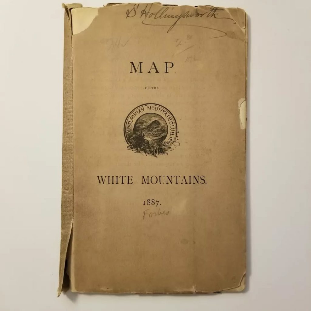
This is the @appalachianmountainclub ‘s (AMC) first standalone map of the White Mountains. I found this copy with the help of @jkelleyupnorth at a bookstore in Boston this summer. It’s hard to find; just four online sale records from the last 15 years. Graciously, Jack let me have it!
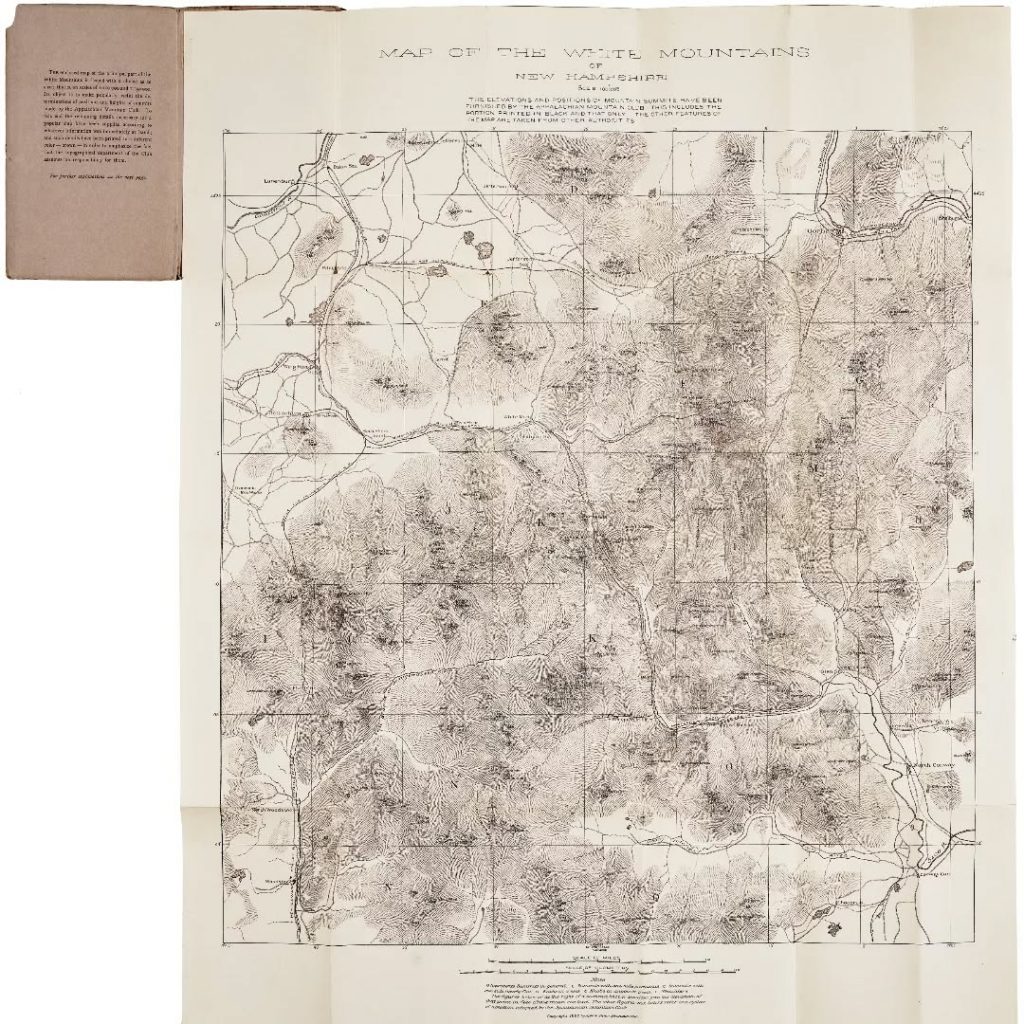
Cartographically, this map is unusual. It sports a unique system of nomenclature and symbology and a now obscure method for depicting topography.
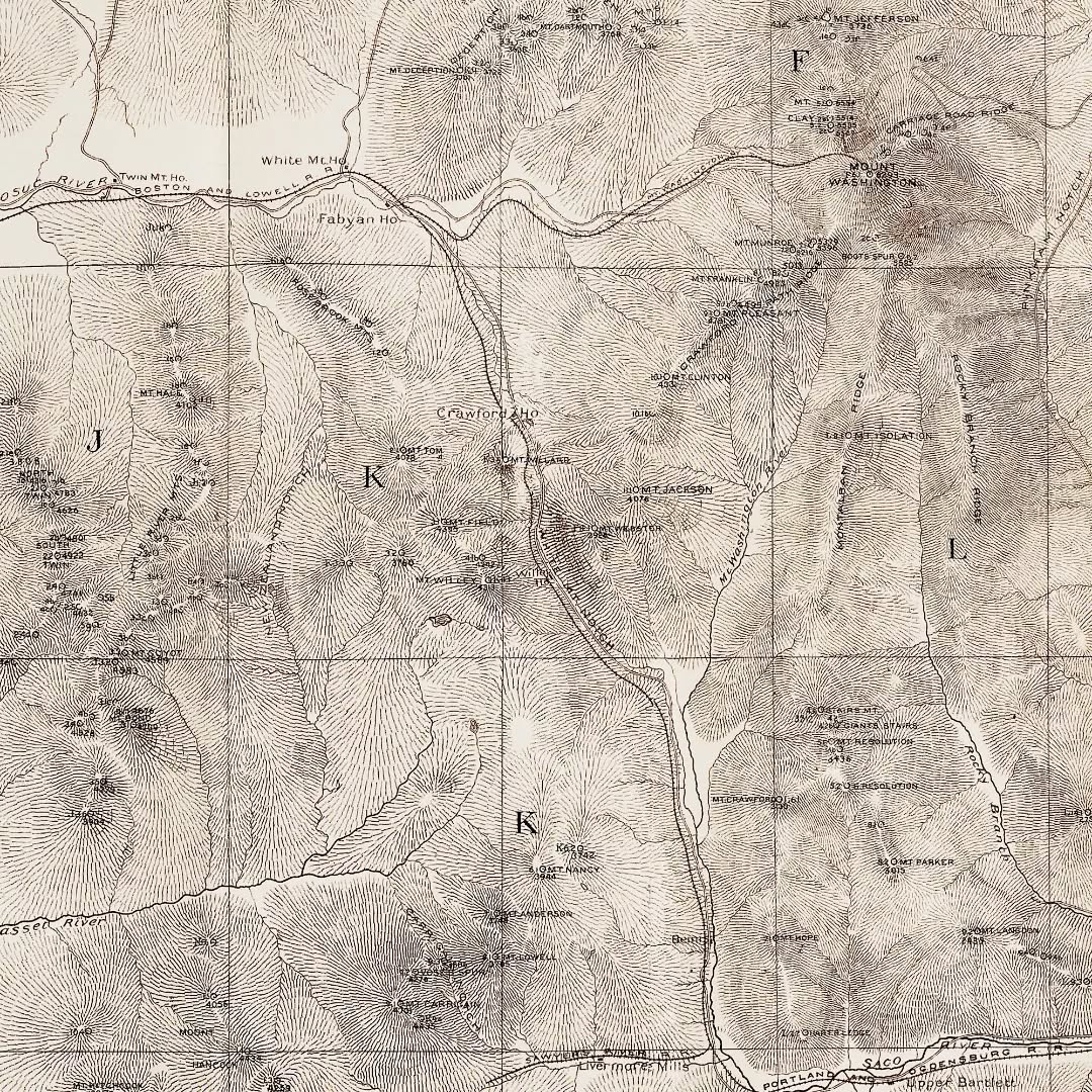
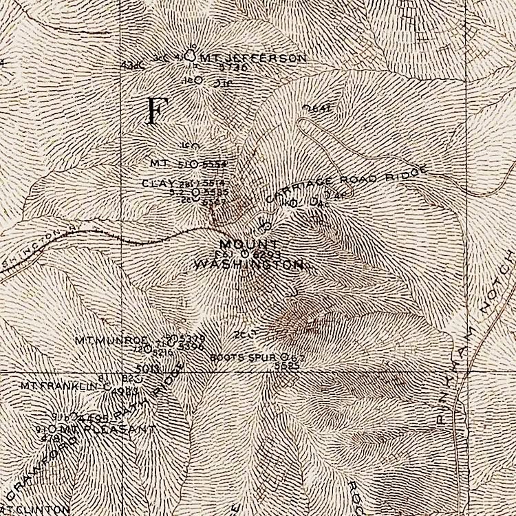
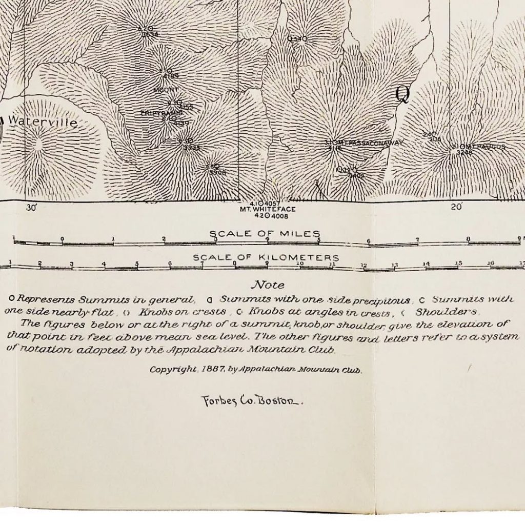
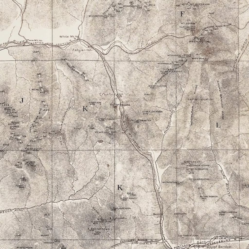
Each summit has an alphanumeric code and a symbol. For example, the code for Mt. Washington is F6.1, meaning the summit is in Area 6 of Region F and it is the tallest (1) peak in Area 6.
Mt. Washington’s symbol is ◯ indicating a summit with no steep or “precipitous” faces (see image 4). According to the key, the symbol “ꓷ” indicates a summit with one side steep and “C” a summit with one side flat. Topography is represented with hachuring, lines showing the orientation of slope.
These methods were soon abandoned in favor of the contour lines we are familiar with today, adopted most notably by the United States Geological Survey (USGS). However, much of the AMC’s summit elevation data, much of it collected by members, stands the test of time and is not far off modern surveys.
‘Pocket maps’ such as this one came with book-like covers to protect the contents while in the field. The front cover of this copy bears the name “S. Hollingsworth.” A bit of googling unearthed Sumner Hollingsworth, a paper manufacturer from South Braintree and member of the AMC in 1888.
The scans of the map (images 2-5) are courtesy of @bostonraremaps (theirs is in nicer shape than mine).
Originally published on Instagram September 7, 2023.