Author: Floyd Greenwood

  • Tip Top House

    Tip Top House

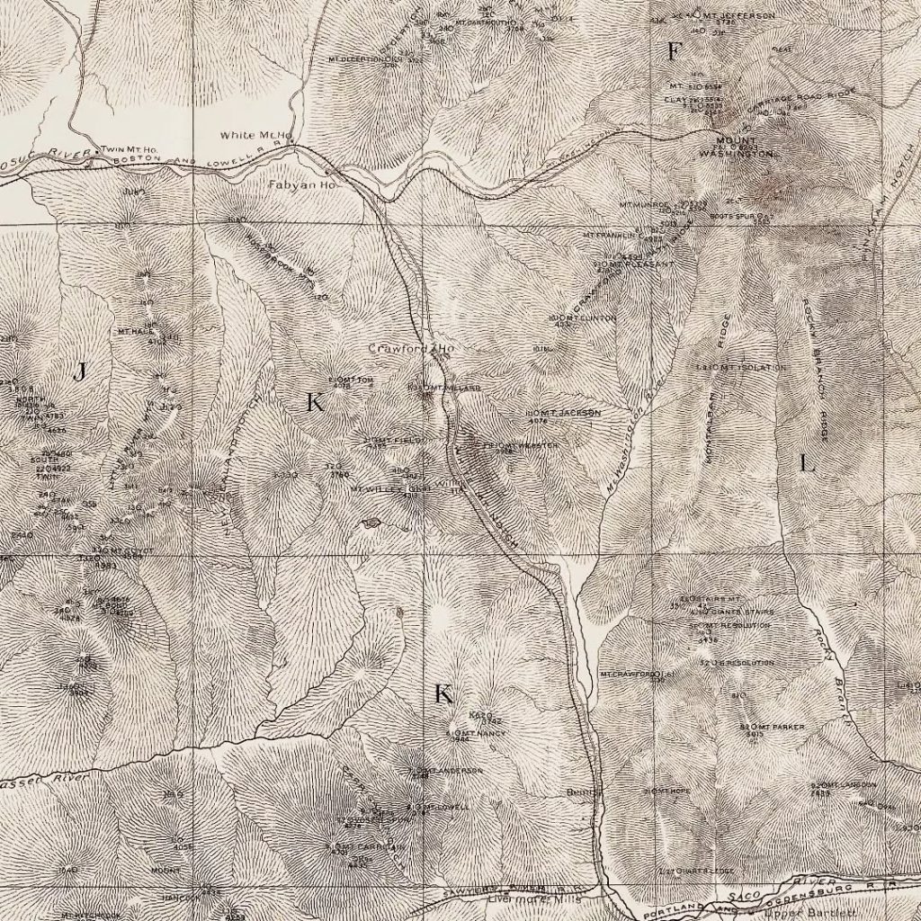
    It was a stormy day at the Brimfield Flea Market last September. So much so a tree fell across my driveway and nearly blocked me out. But I didn’t know that yet. I had a set of early National Geographic maps tucked under my arm that I got for a steal, and couldn’t let a drop of water soil my new treasures, no matter how nominal the cost. There came a gap in the rain so I took advantage of it and moved to a different tent.

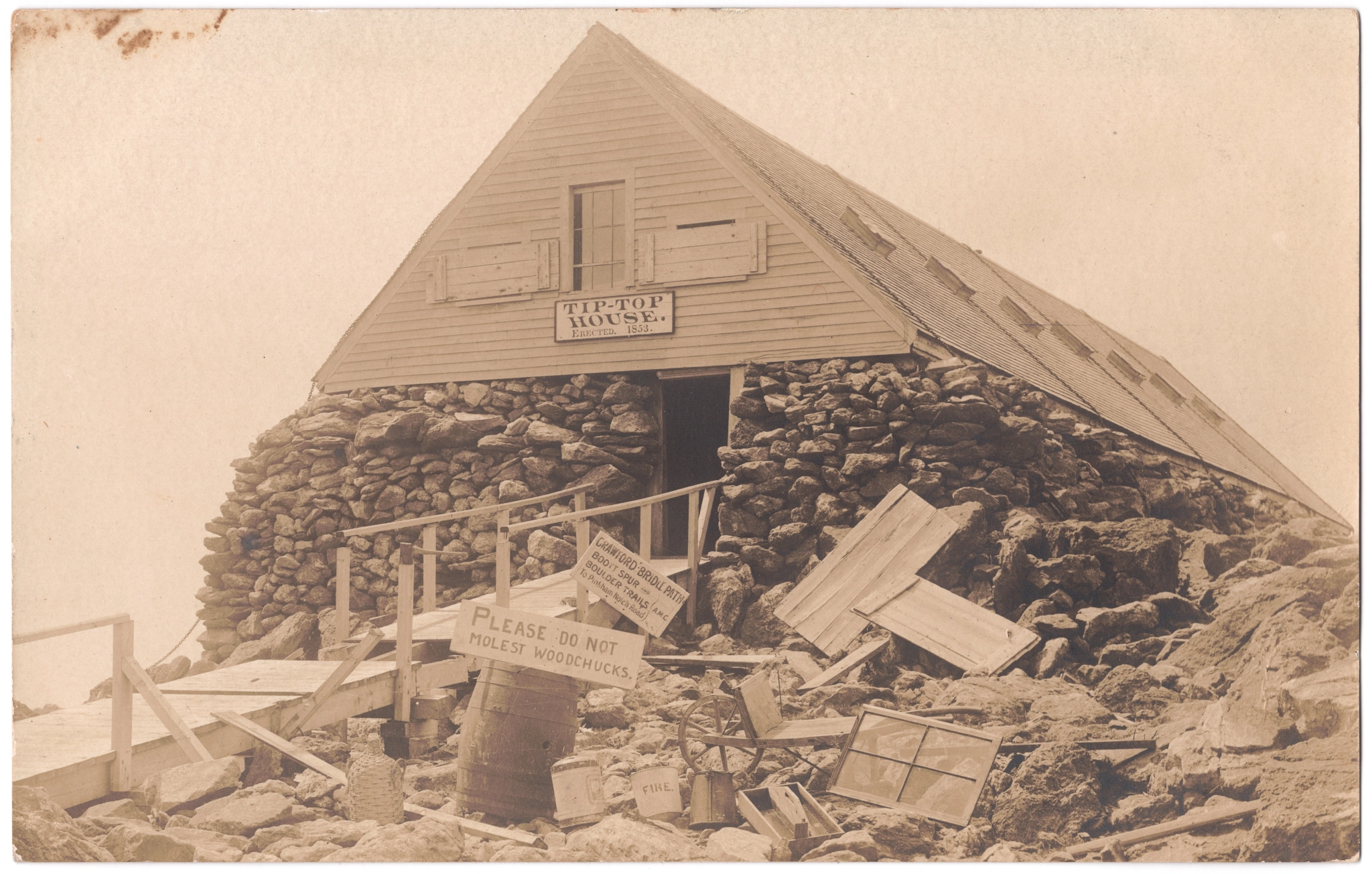
    Each dealer had their own white party tent to display their wares. I took shelter in a booth just as the thunder boomed and the rain commenced again. This dealer specialized in post cards. I found the New Hampshire box and pulled out the card you see above. It’s a real photo postcard (RPPC)1 depicting the Tip Top House on Mt. Washington. There are many pictures of this hotel out there, but this one is unlike any other I’ve seen. Scrap wood and miscellaneous materials are strewn about the foreground. Identifiable objects include an AMC trail sign, another sign on top of a barrel saying “Please do not molest woodchucks,” a wheelbarrow, hatchet, window, fire bucket, toolbox, and window shutters.

    The scene piqued my curiosity. It’s not everyday you see bric-a-brac outside an upscale hostelry. The card is unused and has no written information, except of course the resident woodchuck population on Mt. Washington. When the rain subsided I bought the card and returned to my car.

    Rear side of the postcard. The different fading on the edges suggests it was once in an album.

    Narrowing the date of this postcard was a fun task. First, there are a couple of clues on the back. The stamp box has the letters “AZO” and four upward pointing triangles at each corner, a design used from 1904-1918.2 It is a divided back card, a style used between 1907 and 1915.

    Returning to the photograph, here’s where it gets interesting. There’s a trail sign in the photo listing the Crawford Bridle Path, Boott Spur, and Boulder trails. Boulder presumably refers to the Glen Boulder Trail. According to the AMC White Mountain Guide of 1920, the Boott Spur Trail was constructed in 1900 and Glen Boulder by 1906, so the photo must postdate that, although it does not narrow down the date range any further. The Tip Top House burned on August 29, 1915 and was subsequently rebuilt, but that doesn’t narrow the date either. Ironically, there’s a fire bucket in the foreground.

    I continued my search on the AMC Archives website. There was another fire on Mt. Washington June 18, 1908. All the summit buildings burned except the Tip Top House. I found one image of this event with Tip Top House in the background.3 The break in the boardwalk railing in the postcard match that of the AMC photo. It makes sense, too, for a fire bucket to be out after a blaze, not to mention scattered materials and debris. I believe this postcard dates to June 1908!

    I’ve seen other photos from the 1908 fire since writing above,4 and the broken railing seems to be the best identifier of photos taken immediately after the disaster.

    The photographer is unknown, but possibly Guy Shorey, who sold his own postcards in Gorham, NH. He visited the summit ruins the morning after the fire.5

    Footnotes

    1. Real photo postcards are photographs produced directly on post card stock. Learn more about the medium on Wikipedia. ↩︎
    2. Playle, David, “How to Identify and Date Real Photo Vintage Postcards,” playle.com, David Playle, https://www.playle.com/realphoto/. ↩︎
    3. [The summit of Mount Washington, N.H., showing the aftermath of the Great Fire of 1908, with the Tip Top House and the Cog Railway track], June 19, 1908, LS35.03, lantern slide, Appalachian Mountain Club Library & Archvies, AMC Highland Center at Crawford Notch, Bretton Woods, NH, https://outdoors.catalogaccess.com/photos/1585. ↩︎
    4. Russack, Rick, “Fire on the summit: 101 years ago,” White Mountain History, WhiteMountainHistory.org, https://www.whitemountainhistory.org/fire-on-mt-washington. A better photo of the broken railing is in the gallery at the bottom of the page. ↩︎
    5. Ibid. ↩︎

  • The Andover Paper Mill

    The Andover Paper Mill

    When held up to the light, this deed from 1805 reveals the watermark “Andover!”

    The paper was manufactured at Samuel Phillips Jr.’s (1752-1802) mill on the Shawsheen River. He began operations in 1775 producing gunpowder for the Continental Army. George Washington apparently disliked it, and after a series of deadly accidents, Phillips gradually substituted it for papermaking.

    It, too, had its issues at first, but proved to be a successful venture. Among his clientele were the State printers, in no small part due to his extensive connections to and involvement in the state government. He was elected lieutenant governor in 1801, but died just a year later.

    Phillips’ son John continued the business until 1820, not long after which it became part of Abraham Marland’s cotton mill. No parts of the paper mill survive, but mill buildings on the site dating as far back as the 1830’s remain, repurposed as apartment complexes.

    This image has an empty alt attribute; its file name is 20240601_194415.jpg
    A portion of the Marland Mill today along the Shawsheen River. It is now a retirement community.

    Samuel Phillips wrote the following describing his paper mill:

    “A building occupied as a Paper Mill, 36 by 32 feet, with two vats upon the ground floor, which have a Cast Iron pot in each of them, sunk into Brick chimneys, for heating the vats. The first floor has two-engines for beating-stuff, a room for dressing rags, with a brick chimney and fire place, also two other rooms for rags. The second floor is occupied for a Rag ware-house.

    “Another building connected to the mill by a covered passage way of 20 ft. long, used for drying and keeping paper before finished, 20 by 24 feet, at the end next the mill ; a part of the drying-house is taken off for a finishing room, 27 by 24 feet, in which is a cast-iron stove used in the winter season…No other building near on the same side of the river. A Grist Mill upon the opposite side of the river, at about 140 feet distance.”

    Detail of Moses Dorman’s map of Andover, 1830, showing the Marland Mill that succeeded Phillips’ paper and gunpowder mills.

    Phillips and his contemporaries used a traditional, handmade paper-making process, the product of which is known as “laid” paper. It starts with the production of pulp by cutting, washing, and heating cotton, linen, or other fibers and mixing it with water in large vats. The pulp is then filtered out of the vats with screened molds and left to dry. Laid paper is identified by the so-called “chain lines” left by the screen. Below is a video recreating the process from the University of Iowa:

    Originally published on HistoryBuzz.


    Bibliography

    Sarah Loring Bailey, Historical Sketches of Andover (Comprising the Present Towns of North Andover and Andover), Massachusetts (Boston: Houghton, Mifflin and Company, 1880), 580-585, https://archive.org/details/historicalsketch00bail.

  • Old Feather Store

    Old Feather Store

    The Stanbury House (Old Feather Store) with Faneuil Hall and Dock Square in the background, about 1860, and the same site December, 2024 (below).

    The Old Feather Store was built ca.1680 for Thomas and Susanna Stanbury in the aftermath of a fire in August 1679. It was a commercial building, home to merchants of hardware, West India goods, clothing, and its namesake feathers. By the mid-19th century, it was likely one of just a handful of surviving First Period (Postmedieval English) structures in Boston’s urban center, appearing in a number of photographs in the years before its demolition in July 1860.

    From these photographs and as well from written accounts we know the building was timber-framed, but covered with roughcast plaster mixed with gravel and crushed glass to comply with fire prevention laws. Another notable feature evident in the photo is its framed overhang where the second floor footprint extends beyond that of the first to maximize floor space while conforming to a tight lot.

    The ca.1860 photograph was published as a stereoview card by DeLos Barnum in the early-mid 1860s from his office in Roxbury.

    Originally published on Instagram December 13, 2024.

  • AMC Map 1887

    AMC Map 1887

    This is the @appalachianmountainclub ‘s (AMC) first standalone map of the White Mountains. I found this copy with the help of @jkelleyupnorth at a bookstore in Boston this summer. It’s hard to find; just four online sale records from the last 15 years. Graciously, Jack let me have it!

    Cartographically, this map is unusual. It sports a unique system of nomenclature and symbology and a now obscure method for depicting topography.

    Each summit has an alphanumeric code and a symbol. For example, the code for Mt. Washington is F6.1, meaning the summit is in Area 6 of Region F and it is the tallest (1) peak in Area 6.

    Mt. Washington’s symbol is ◯ indicating a summit with no steep or “precipitous” faces (see image 4). According to the key, the symbol “ꓷ” indicates a summit with one side steep and “C” a summit with one side flat. Topography is represented with hachuring, lines showing the orientation of slope.

    These methods were soon abandoned in favor of the contour lines we are familiar with today, adopted most notably by the United States Geological Survey (USGS). However, much of the AMC’s summit elevation data, much of it collected by members, stands the test of time and is not far off modern surveys.

    ‘Pocket maps’ such as this one came with book-like covers to protect the contents while in the field. The front cover of this copy bears the name “S. Hollingsworth.” A bit of googling unearthed Sumner Hollingsworth, a paper manufacturer from South Braintree and member of the AMC in 1888.

    The scans of the map (images 2-5) are courtesy of @bostonraremaps (theirs is in nicer shape than mine).

    Originally published on Instagram September 7, 2023.